1501 Will Rogers State Park Road Pacific Palisades Open 8 A.M. 5 P.M. Daily
Hiking Distance: 2-Mile Loop Hiking Time: 1 Hour Configuration: Loop Elevation Gain: 300 Feet Difficulty: Easy Exposure: Exposed Dogs: Allowed
Maps: U.S.G.S. Topanga Topanga State Park Map Tom Harrison Maps: Topanga State Park Trail Map
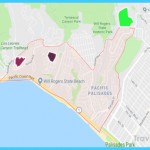
Will Rogers State Historic Park Is A 186-Acre Retreat In The Hills Above Santa Monica. The Land Was Set Aside As A State Park In 1944. Within The Parkland Are Picnic Grounds, Horse Riding Stables, And Trails With Spectacular Views. Tours Of Will Rogers’ 31-Room Ranch Home Are Offered Daily.
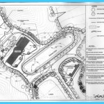
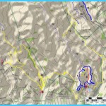
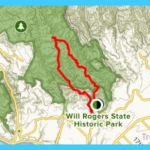
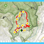
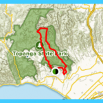
Will Rogers State Historic Park Map Photo Gallery
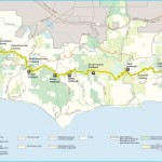
At The Upper Reaches Of The Park Is Inspiration Point, A Broad, Flat Knoll Overlooking The Beautiful Park Grounds And The Rugged Mountain Canyons And Ridges. The Expansive Views From The 751-Foot Overlook Extend From Downtown Los Angeles To Santa Monica And Across Santa Monica Bay To Palos Verdes. Inspiration Point Loop Trail, Designed By Rogers Himself, Is A Two-Mile Trail That Climbs The Undeveloped Hillside Behind The Ranch To Inspiration Point. The Top Of The Loop Connects With The Eastern Terminus Of The Backbone Trail, Which Crosses The Spine Of The Santa Monica Mountains For 69 Miles To Point Mugu State Park. For Longer Hiking Options, Take The Backbone Trail To Rustic Canyon (Hike 74) Or Temescal Peak (Hike 75).
To The Trailhead From Santa Monica, Drive 1.6 Miles Northbound On The Pacific Coast Highway/Highway 1 To Chautauqua Boulevard. Turn Right And Continue 0.9 Miles To Sunset Boulevard. Turn Right Again. Drive 0.5 Miles And Turn Left At Will Rogers State Park Road. The Parking Area Is 0.7 Miles Ahead On The Left, Just Past The Entrance Station. Another Parking Lot Is A Short Distance Farther, On The Left By The Visitor Center. A Parking Fee Is Required.
The Hike
Begin The Hike From The Visitor Center And Will Rogers’ Home, Built In 1928. Head West (Left) Past The Tennis Courts And The Temescal-Rivas Canyon Trail To A Dirt Fire Road The Inspiration Loop Trail. Head Uphill On The Gentle Slope, With Views Across Coastal Los Angeles To Palos Verdes And Catalina Island. Climb The Ridge To The North Above Rivas Canyon, With Additional Views Across The Mountainous Backcountry, To A Junction At 0.8 Miles. The Left Fork Begins The First Segment Of The Backbone Trail On The Rogers Road Trail (Hike 74). Detour 0.1 Mile To The Right To Inspiration Point, An Overlook On A Flat-Topped Knoll. After Resting And Savoring The Views Of The Entire State Park, Santa Monica Bay, And The Greater Los Angeles Area, Return To The Junction.
Take The Fork That Is Now On Your Right (Northeast). Pass The Beginning Of The Backbone Trail On The Left By An Information Kiosk. Stay On The Main Trail And Continue Northeast. Descend To The South, Overlooking The Polo Field At The Base Of The Hill. Walk Through A Eucalyptus-Lined Lane, Returning To The Well-Maintained Park Grounds And Visitor Center.
1501 Will Rogers State Park Road Pacific Palisades
Hiking Distance: 5-Mile Loop
Hiking Time: 3 Hours
Configuration: Loop
Elevation Gain: 1,000 Feet
Difficulty: Moderate To Somewhat Strenuous
Exposure: Exposed Ridge And Forested Canyon
Dogs: Allowed On Inspiration Loop Trail Only
Maps: U.S.G.S. Topanga Topanga State Park Map Tom Harrison Maps: Topanga State Park Trail Map
Rustic Canyon Is A Lush, Stream-Fed Canyon To The Northeast Of Will Rogers State Historic Park. This Hike Begins In The State Park On The Inspiration Loop Trail, Then Returns Back Through Secluded Rustic Canyon. En Route, The Hike Connects With The Rogers Road Trail, The Easternmost Segment Of The Backbone Trail. The Trail Straddles The Razor-Point Ridge Between Rustic And Rivas Canyons. From The Ridge, The Canyon And Ocean Views Are Spectacular.
The Return Trail Along The Narrow Floor Of Steep-Walled Rustic Canyon Passes Three Old Abandoned Structures. The Dilapidated, Graffiti-Covered Buildings Are The Remnants Of A 50-Acre Pro-Nazi Compound Known As Murphy Ranch. The Colony Of Nazi Sympathizers Occupied The Canyon From 1933 To 1945. The Enclave Later Became An Artists’ Colony In The 1950s And 1960s. After Passing The Structures, The Trail Parallels The Year-Round Watercourse Of Rustic Creek Through A Narrow Canyon Before Looping Back To Will Rogers State Park.
To The Trailhead
From Santa Monica, Drive 1.6 Miles Northbound On The Pacific Coast Highway/Highway 1 To Chautauqua Boulevard. Turn Right And Continue 0.9 Miles To Sunset Boulevard. Turn Right Again. Drive 0.5 Miles And Turn Left At
Will Rogers State Park Road. The Parking Area Is 0.7 Miles Ahead On The Left, Just Past The Entrance Station. Another Parking Lot Is A Short Distance Farther, On The Left By The Visitor Center. A Parking Fee Is Required.
Maybe You Like Them Too
- The Best Places To Visit In North America For Christmas
- Faro Travel Guide: Map of Faro
- Mumbai Travel Guide For Tourists: Map Of Mumbai
- Travel to Budapest
- Thailand Travel Guide for Tourists: The Ultimate Thailand Map

