2577 S. Encinal Canyon Road
Open Daily 8:00 A.M. To Sunset
Hiking Distance: 3-Mile Loop Hiking Time: 1.5 Hours
Configuration: Loop Plus Optional Connecting Trails Elevation Gain: 600 Feet Difficulty: Easy
Exposure: Exposed With Forested Pockets Dogs: Allowed
Maps: U.S.G.S. Triunfo Pass City Of Malibu-Charmlee Natural Area Map Tom Harrison Maps: Zuma-Trancas Canyons Trail Map
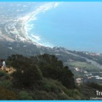
Perched On Oceanfront Cliffs 1,300 Feet Above The Sea, Charmlee Wilderness Park Has A Magnificent Bird’S-Eye View Of The Malibu Coastline. The 532-Acre Wilderness Park, Sitting Between Encinal Canyon And Lechusa Canyon, Was Once A Cattle Ranch.
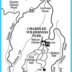
Charmlee Wilderness Park Map Photo Gallery
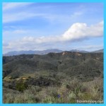
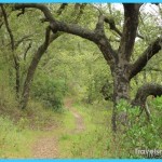
The Land Was Purchased By Los Angeles County In 1968 And Opened As A Park In 1981. Eight Miles Of Interconnecting Footpaths And Old Ranch Roads Weave Through Expansive Mountain Terrain With Grassy Meadows, Oak And Eucalyptus Woodlands, Mountain Slopes, Rocky Ridges, Sandstone Formations, And 1,250-Foot Bluffs Overlooking The Sea. The Park Has Picnic Areas And A Nature Center With Plant Exhibits. This Hike Crosses The Bluffs Through Meadows And Forest Groves To The Old Ranch Reservoir And Oceanfront Overlooks.
Charmlee Wilderness Park
From Santa Monica, Drive 23.2 Miles Northbound On The Pacific Coast Highway/Highway 1 To Encinal Canyon Road And Turn Right/North. (Encinal Canyon Road Is 11.2 Miles West Of Malibu Canyon Road.) Continue 3.7 Miles To The Park Entrance On The Left. Turn Left And Drive 0.2 Miles On The Park Road To The Parking Lot. A Parking Fee Is Required.
From The Pacific Coast Highway/Highway 1 And Las Posas Road In Southeast Oxnard, Drive 14 Miles Southbound On The Pch To Encinal Canyon Road And Turn Left. Continue 3.7 Miles To The Charmlee Park Entrance On The Left. Follow The Park Road 0.2 Miles To The Parking Lot.
The Hike
Hike Past The Information Board And Picnic Area On The Wide Trail. Pass A Second Picnic Area On The Left In An Oak Grove, And Continue Uphill To A Three- Way Trail Split. The Middle Trail Is A Short Detour Leading To An Overlook Set Among Rock Formations And The Old Ranch House Foundation. Take The Main Trail To The Left Into The Large Grassy Meadow. Two Trails Cross The Meadow And Rejoin At The South End The Main Trail (Potrero Road) Heads Through The Meadow While The Right Fork (West Meadow Trail) Skirts The Meadow’S Western Edge. At The Far End Is An Ocean Overlook And A Trail Fork. Bear Left Past An Old Ranch Reservoir, And Pass Two Junctions To A 1,200-Foot Overlook On The Right. Continue Downhill, Curving North Through An Oak Grove To The Unsigned Botany Trail, A Narrow Footpath On The Right. The Botany Trail Winds Back To The Picnic Area And The Trailhead.
Maybe You Like Them Too
- The Best Places To Visit In North America For Christmas
- Faro Travel Guide: Map of Faro
- Mumbai Travel Guide For Tourists: Map Of Mumbai
- Travel to Budapest
- Thailand Travel Guide for Tourists: The Ultimate Thailand Map

