5970 Palos Verdes Drive South
Hiking distance: 2 miles round trip Hiking time: 1 hour Configuration: two loops Elevation gain: 150 feet Exposure: exposed coastline Difficulty: easy Dogs: allowed.
Maps: U.S.G.S. Redondo Beach and San Pedro
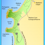
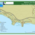
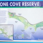
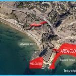
Abalone Cove Shoreline Park and Ecological Preserve is a federal reserve where grassy 180-foot bluffs offer easy access to the rocky shoreline. The 80- acre preserve extends from Abalone Cove to Portuguese Point and Sacred Cove (also known as Smugglers Cove). Sacred Cove is bordered by tidepools at both points. From Portuguese Point are magnificent views of Abalone Cove, Long Point (Hike 52), Sacred Cove, Inspiration Point, White Point, Point Fermin (Hike 56), and Catalina Island. The oceanfront park sits at the foot of the unstable and actively slipping Portuguese Bend landslide area.
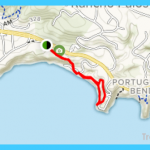
Abalone Cove and Portuguese Point Map Photo Gallery
To the trailhead
From the Pacific Coast Highway/Highway 1 at the south end of Torrance, take Hawthorne Boulevard south 7.3 miles to its terminus at the coast. Turn left on Palos Verdes Drive South, and drive 2.2 miles to the posted Abalone Cove Shoreline Park entrance. Turn right and park in the lot. A parking fee is required.
The hike
From the east end of the parking lot, cross the grassy picnic area onto a wide gravel path. Continue to a vehicle-restricted road. Bear left and wind up the hillside on the vehicle-restricted road to Palos Verdes Drive. Bear to the left on the narrow path, parallel to the highway, for 0.2 miles to the Portuguese Point access. Walk up the curving, gated road to the north edge of the peninsula and a trail split. First, take the left fork out to Portuguese Point, which stays atop the peninsula and loops around the perimeter.
After enjoying the awesome coastal views from the point, return to the trail split Take the left fork down to the beach and tidepools near an old rock enclosure. The trail to the left leads to the base of the cliffs at Portuguese Point. To return, follow the shoreline trail back along Abalone Cove for 0.4 miles to Upper Beach, a raised, man-made sandy beach and lifeguard station just above the rocky shore. Curve right and take the old paved road to a trail junction.
The footpath to the left ascends the cliffs through the dense brush, back to the parking lot.
Maybe You Like Them Too
- The Best Places To Visit In North America For Christmas
- Faro Travel Guide: Map of Faro
- Mumbai Travel Guide For Tourists: Map Of Mumbai
- Travel to Budapest
- Thailand Travel Guide for Tourists: The Ultimate Thailand Map

