I. Introduction
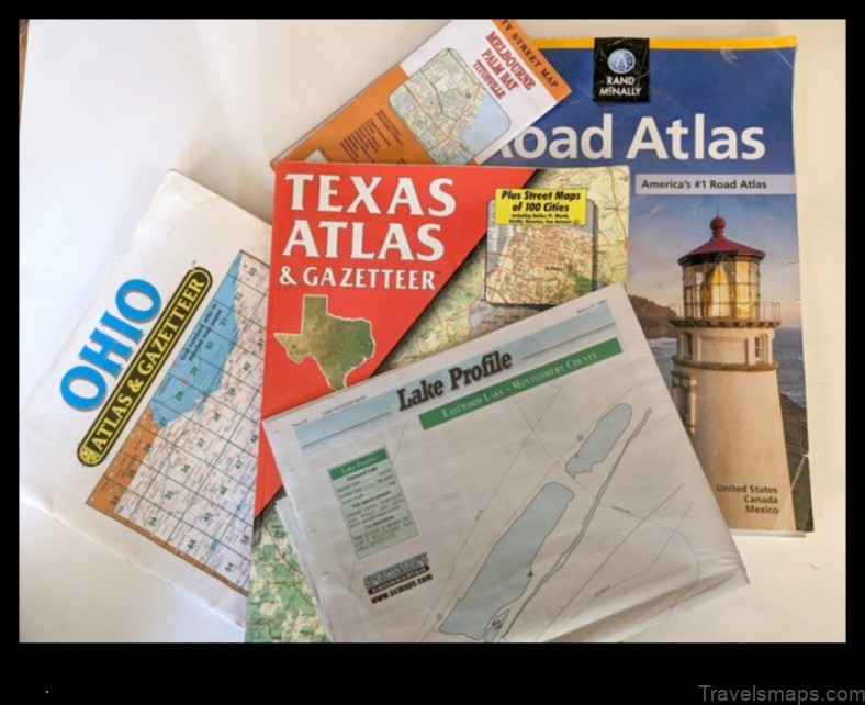
A map is a graphic representation of a geographical area, such as a country, region, or city. Maps are used to provide information about the location of features, such as roads, buildings, and landmarks. They can also be used to show the relationships between different features, such as how far apart they are or which direction they are in.
Maps are an essential tool for navigation, planning, and communication. They are used by people in all walks of life, from explorers and scientists to tourists and commuters.
II. What is a map?
A map is a graphic representation of a geographical area. Maps are used to provide information about the location of features, such as roads, buildings, and landmarks. They can also be used to show the relationships between different features, such as how far apart they are or which direction they are in.
Maps are created by using a variety of techniques, including:
- Remote sensing
- Surveying
- Photogrammetry
- Cartography
Remote sensing is the process of collecting data about an object or area from a distance, without being in direct contact with it. This data can be used to create maps of the object or area.
Surveying is the process of measuring the size, shape, and elevation of an area of land. This data can be used to create maps of the area.
Photogrammetry is the process of creating a map from a series of photographs. This technique is often used to create maps of remote or inaccessible areas.
Cartography is the art and science of creating maps. Cartographers use a variety of tools and techniques to create maps that are accurate, informative, and easy to use.
III. Different types of maps
There are many different types of maps, each designed for a specific purpose. Some of the most common types of maps include:
- Topographic maps
- Road maps
- Political maps
- Thematic maps
Topographic maps show the physical features of an area, such as mountains, rivers, and lakes. Road maps show the roads and highways in an area. Political maps show the political boundaries of an area. Thematic maps show the distribution of a particular feature or phenomenon, such as population density or rainfall.
IV. How to read a map
Reading a map can be a challenge, but it is a skill that can be learned with practice. The following tips can help you read a map:
- Identify the map’s scale. The scale of a map shows how much distance is represented by a certain amount of space on the map.
- Identify the map’s orientation. The orientation of a map shows which direction is north.
- Identify the map’s features. The features of a map include the roads, rivers, lakes, mountains, and other landmarks.
V. The importance of maps
Maps are an essential tool for navigation, planning, and communication. They are used by people in all walks of life, from explorers and scientists to tourists and commuters.
Maps can help you find your way around a new city, plan a trip, or navigate a foreign country. They can also be used to study the environment, track the spread of diseases, or plan military operations.
Maps are a powerful tool that can be used to improve our understanding of the world around us. They can help us to see the big picture and to make informed decisions about our lives.
VI. Using maps for navigation
Maps can be used for navigation in a variety of ways. Some of the most common ways to use maps for navigation include:
- Using a map to find your way around a new city
- Using a map to plan a trip
- Using a map to navigate a foreign country
When using a map for navigation, it is important to be aware of the map’s scale and orientation. It is also important to be able
| Feature | Description |
|---|---|
| Jalbūn | A town in the West Bank and Gaza Strip |
| West Bank | A region of Palestine |
| Gaza Strip | A region of Palestine |
| Map | A representation of an area of land |
| Palestine | A country in the Middle East |
II. What is a map?
A map is a graphic representation of a geographic area, such as a city, country, or continent. Maps are used to show the location of features such as roads, rivers, and buildings. They can also be used to show the elevation of land, the distribution of population, or the boundaries of political entities.
Maps are essential tools for navigation, planning, and communication. They can help us to understand the world around us and to make informed decisions about where to go and what to do.
III. Different types of maps
There are many different types of maps, each designed for a specific purpose. Some of the most common types of maps include:
Topographic maps show the physical features of an area, such as mountains, rivers, and lakes.
Political maps show the political boundaries of an area, such as countries, states, and provinces.
Road maps show the roads and highways in an area.
Tourist maps show tourist attractions and other points of interest in an area.
Land-use maps show how land is used in an area, such as for agriculture, forestry, or residential development.
Climate maps show the average temperature and precipitation in an area.
Environmental maps show the environmental features of an area, such as wetlands, forests, and deserts.
Historical maps show how an area has changed over time.
The type of map you need will depend on the purpose for which you are using it. For example, if you are planning a trip, you will need a road map. If you are interested in learning more about the history of an area, you will need a historical map.
When choosing a map, it is important to consider the scale of the map. The scale of a map is the ratio of the distance on the map to the actual distance on the ground. A large-scale map shows a small area in great detail, while a small-scale map shows a large area in less detail.
It is also important to consider the accuracy of the map. The accuracy of a map is determined by the methods used to create the map and the quality of the data used.
Finally, you should consider the ease of use of the map. The map should be easy to read and understand, with clear labels and symbols.
4. Jalbūn
Jalbūn is a town in the West Bank and Gaza Strip. It is located in the northern part of the West Bank, near the border with Israel. The town has a population of around 10,000 people.
Jalbūn is a historical town with a rich history. It was first mentioned in the Bible as a place where the Israelites camped during their Exodus from Egypt. The town was also a major center of trade during the Ottoman Empire.
Today, Jalbūn is a thriving town with a strong economy. The town is home to a number of businesses, schools, and mosques. Jalbūn is also a popular tourist destination, with many visitors coming to see the town’s historical sites.
V. The importance of maps
Maps are essential tools for navigation, planning, and communication. They provide a visual representation of the world around us, and they help us to understand how different places are connected. Maps can be used to find our way from one place to another, to plan a trip, or to learn about the history of a particular area.
Maps are also used for a variety of other purposes, such as:
- Military planning
- Natural resource management
- Environmental protection
- Economic development
- Education
In short, maps are essential tools that we use every day to navigate the world around us. They provide us with information that is essential for our safety, our well-being, and our understanding of the world.
VI. Using maps for navigation
Maps can be used for navigation in a variety of ways. They can be used to find your way around a city, a country, or the world. Maps can also be used to plan trips, find directions, and avoid traffic jams.
There are a number of different ways to use maps for navigation. You can use a paper map, a digital map, or a GPS device. Each type of map has its own advantages and disadvantages.
Paper maps are lightweight and easy to use, but they can be difficult to read when you are moving quickly. Digital maps are more accurate and easier to read, but they can be expensive and require a power source. GPS devices are very accurate and easy to use, but they can be expensive and may not work in all areas.
When choosing a map for navigation, it is important to consider the following factors:
- The size of the area you need to navigate
- The level of detail you need
- The ease of use
- The cost
Once you have considered these factors, you can choose the best map for your needs.
VII. Maps in history
Maps have been used for centuries to depict the world around us. They have been used for navigation, exploration, warfare, and diplomacy. In this section, we will explore the history of maps and how they have evolved over time.
The earliest known maps date back to the 3rd millennium BC. These maps were created by the Babylonians and Egyptians and were used for navigation and land surveying. The first maps to depict the entire world were created by the Greeks and Romans in the 1st century BC. These maps were based on the geocentric model of the universe, which placed the Earth at the center of the universe.
In the Middle Ages, maps were used for religious purposes. They were used to depict the Garden of Eden, the Holy Land, and other religious sites. During the Renaissance, maps became more accurate and detailed. They were used by explorers to map new lands and by cartographers to create accurate maps of the world.
In the 19th century, maps were used for military purposes. They were used to plan troop movements and to create battle plans. In the 20th century, maps were used for a variety of purposes, including navigation, weather forecasting, and land surveying.
Today, maps are still used for a variety of purposes. They are used for navigation, exploration, warfare, and diplomacy. They are also used for a variety of other purposes, such as education, entertainment, and marketing.
Maps in popular culture
Maps have been used in popular culture for centuries to tell stories, convey messages, and entertain. In recent years, maps have become increasingly popular in film, television, and other forms of media.
Some of the most famous maps in popular culture include:
- The map of Middle-earth in The Lord of the Rings
- The map of Westeros in Game of Thrones
- The map of the United States in The West Wing
- The map of the world in Star Trek
Maps in popular culture can serve a variety of purposes. They can:
- Create a sense of place
- Tell a story
- Convey a message
- Entertain
Maps in popular culture can also be used to raise awareness of important issues, such as climate change, poverty, and war.
In recent years, there has been a growing trend of using maps in social media and other online platforms. This trend is likely to continue as maps become more accessible and easier to use.
IX. The future of maps
The future of maps is bright. With the increasing availability of data and the development of new technologies, maps are becoming more and more accurate, detailed, and interactive.
In the future, maps will be used for a wider variety of purposes than ever before. They will be used for navigation, planning, and decision-making. They will also be used to provide information about the environment, the economy, and society.
Maps will be increasingly personalized and customized. They will be tailored to the needs of individual users, providing them with the information they need to make informed decisions.
Maps will also be more interactive. Users will be able to zoom in and out, pan around, and explore different layers of information. They will be able to create their own maps and share them with others.
The future of maps is exciting. Maps are becoming more powerful tools than ever before, and they are helping us to understand the world around us.
X. FAQ
Q: What is Jalbūn?
A: Jalbūn is a town in the West Bank and Gaza Strip.
Q: What does the map show?
A: The map shows the location of Jalbūn in the West Bank and Gaza Strip.
Q: How can I use the map?
A: You can use the map to find your way around Jalbūn, or to plan a trip to the area.
Table of Contents
Maybe You Like Them Too
- Godim, Portugal A Visual Guide
- Türnitz, Austria A Map to Your Adventure
- Harthill A Map of the Town
- Lesja, Norway A Map to Your Adventure
- Kirschau Map A Visual Guide to the Town


