El Dorado Park
7550 E. Spring Street Long Beach Open Tues-Sun.
Hiking Distance: 2-Mile Loop Hiking Time: 1 Hour
Configuration: Loop With Opuonal Cut-Across Elevation Gain: Level
Exposure: Shade With Some Exposed Pathways Difficulty: Easy Dogs: Not Allowed
Maps: U.S.G.S. Los Alamitos El Dorado Nature Center Trail Map
El Dorado Park Is A 450-Acre Parkland In Long Beach Just West Of The Los Angeles-Orange County Line. The Park Includes Fishing Lakes, Tree Groves, Picnic Shelters, A Petting Zoo, 4.5 Miles Of Paved Biking Trails, And A Nature Center. The Park Is Divided Into An East Section And A West Section. The Developed West Section Has A Golf Course And Athletic Fields. The West Section Has Interconnecting Roads And Paved Walkways.
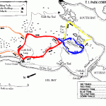
El Dorado Nature Center Map Photo Gallery
This Hike Makes A Loop Through The Least Developed Section Of The Park In The Southwest Corner. The Pastoral 105-Acre Area Is Known As The El Dorado Nature Center. An Interpretive Trail Loops Around Two Lakes And Meanders Through The Sanctuary Along Rolling Hills, Tree-Lined Meadows, Chaparral Communities, Oak Woodlands, And A Stream Connecting The Two Lakes. An
Interpretive Trail Pamphlet Is Available At The Museum.
To The Trailhead
From The 405 (San Diego) Freeway In Long Beach, Take The Studebaker Road Exit. Drive 1.4 Miles North To Spring Street And Turn Right. Continue 0.8 Miles To The Park Entrance On The Right. Park Just Beyond The Entrance Station, Near The Posted Trailhead On The Right. A Parking Fee Is Required.
The Hike
Enter The Lush, Forested Parkland On The Paved Path To The Bridge. Cross The Bridge To The Nature Center Building, Perched On An Island In North Lake.
After Visiting The Center, Loop Clockwise To The Backside Of The Buildings. Cross Another Bridge, Leaving The Island To A 3-Way Junction. The Two Trails On The Right Comprise A Paved Quarter-Mile, Handicapped-Accessible Loop. Take The Unpaved Left Fork Along The West Edge Of North Lake To A Junction.
Begin The One-Mile Trail And Two-Mile Trail Loops To The Right. Parallel North Lake’S Outlet Stream, And Zigzag Up The Chaparral-Covered Hillside, Passing The Observation Tower On The Right, The Highest Point In The Preserve. Descend And Cross The Bridges Over The Stream Two Times. Wind Through Eucalyptus And Oak Groves, And Cross Another Bridge Over The Stream To A Junction. The One-Mile Trail Continues To The Left For A Shorter Loop. Stay To The Right On The Two-Mile Trail, And Descend To The North Shore Of South Lake. Follow The West Edge Of The Lake To The Inlet Stream. Cross A Bridge And Return To The South End Of The Lake. The Meandering Path Returns To The North, Completing The Loop At North Lake. Return To The Right.
Maybe You Like Them Too
- The Best Places To Visit In North America For Christmas
- Faro Travel Guide: Map of Faro
- Mumbai Travel Guide For Tourists: Map Of Mumbai
- Travel to Budapest
- Thailand Travel Guide for Tourists: The Ultimate Thailand Map

