Calabasas Malibu A Free Access Permit Is Required From The Mountains Restoration Trust: (818) 591-1701 Www.Mountainstrust.Org
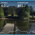
Hiking Distance: 3.3 Miles Round Trip Hiking Time: 1.5 Hours Configuration: Out-And-Back Elevation Gain: 800 Feet Difficulty: Easy To Moderate
Exposure: A Mix Of Exposed Slope And Shaded Streamside Habitat Dogs: Not Allowed
Maps: U.S.G.S. Malibu Beach Tom Harrison Maps: Malibu Creek State Park
Cold Creek Canyon Is A Pristine, Bowl-Shaped Canyon Nestled On The Steep North Slope Behind Saddle Peak (Northeast Of Malibu). Cold Creek, A Perennial Stream And Major Upland Tributary Of Malibu Creek, Flows Through The Preserve.
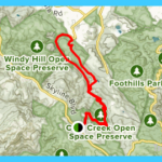
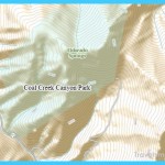
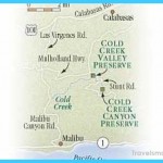
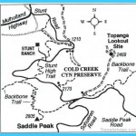
Cold Creek Canyon Preserve Map Photo Gallery
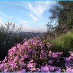
The Cold Creek Watershed Is Among The Most Biologically Diverse Ecosystems In The Santa Monica Mountains. It Supports Manzanita, Chaparral, Coast Live Oak, Sycamore Woodlands, Riparian Streamside Habitats (Including Orchids), A Variety Of Ferns, Phacelia, Cattails, Red Shank, And Humboldt Lily. The 1,100-Acre Nature Preserve Is Owned By The Mountains Restoration Trust, A Non-Profit Land Trust Created To Protect And Enhance The Natural Resources Of The Santa Monica Mountains. To Protect The Fragile Resources Of The Preserve, A Free Access Permit Is Requested (See Contact Information Above).
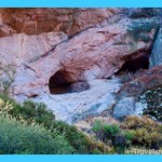
Cold Creek Canyon Has High Ridges, A Steep Slope, Magnificent Sandstone Formations, Rocky Grottoes, Waterfalls, And Canyon Views. The Headwaters Of Cold Creek Originate Within The Preserve, Rising From Springs And Cascading Down Canyon. This Hike Winds Down The North-Facing Watershed Through Lush Streamside Vegetation And Jungle-Like Ferns, Passing Cascades And Small Waterfalls. The Trail Weaves Through The Natural Basin In An Idyllic Setting Under Oak, Maple, Sycamore, And Bay Woodlands. Watch For The Remains Of A 1900s-Era Homesteader House, Hand-Carved Into The Giant Split Sandstone Boulders.
To The Trailhead
From Santa Monica, Drive 12 Northbound On The Pacific Coast Highway/Highway 1 To Malibu Canyon Road And Turn Right. Drive 6.5 Miles To Mulholland Highway. Turn Right And Continue 4 Miles To Stunt Road. Turn Right And Drive 3.3 Miles To The Cold Creek Parking Pullout On The Left By A Chain-Link Fence. Park Off Road On The Shoulder.
From The Ventura Freeway/Highway 101 In Calabasas, Exit On Las Virgenes Road. Head 3 Miles South To Mulholland Highway. Turn Left And Continue 4 Miles To Stunt Road. Turn Right And Drive 3.3 Miles To The Cold Creek Parking Pullout On The Left.
The Hike
Walk Through The Gate In The Chain-Link Fence, And Head East Through The Tall Chaparral. The Trail Leads Gradually Downhill Along The Contours Of The Hillside And Across A Wooden Bridge Over Cold Creek At 0.6 Miles. Pass Moss-Covered Rocks And A Rusty Classic Dodge Truck As You Make Your Way Into The Lush Vegetation And Open Oak Woodland Of The Canyon Floor. Cross Cold Creek Again And Continue Past Large Sandstone Boulders To The Remains Of Gold Miner Herman Hethke’S Stone House. Several Switchbacks Lead Downhill Across Side Streams And Past Small Waterfalls. At 1.6 Miles, The Path Reaches The Locked Lower Gate At Stunt Road. Return By Retracing Your Steps Up Canyon.
Calabasas Malibu
Hiking Distance: 2 Miles Round Trip Hiking Time: 1 Hour Configuration: Out-And-Back Elevation Gain: 200 Feet Difficulty: Easy Exposure: Exposed Dogs: Allowed
Maps: U.S.G.S. Malibu Beach Tom Harrison Maps: Topanga State Park Trail Map
The Topanga Fire Lookout, Ironically, Was Destroyed In A 1970 Fire. All That Remains Is A Large Multi-Level Concrete Foundation Perched At The Edge Of The 2,470-Foot Mountain. A One-Mile Fire Road Leads To The Lookout, Following An Easy Grade Along The East Ridge Of The Cold Creek Canyon Preserve. From The Foundation Are Spectacular Views Into Old Topanga Canyon, Cold Creek Canyon Preserve, Red Rock Canyon, The Expansive San Fernando Valley To Los Angeles, And Santa Monica Bay.
To The Trailhead
From Santa Monica, Drive 12 Miles Northbound On The Pacific Coast Highway/Highway 1 To Malibu Canyon Road. Turn Right And Drive 6.5 Miles To Mulholland Highway. Turn Right And Continue 4 Miles To Stunt Road. Turn Right And Drive 4 Miles Up The Winding Road To The End Of Stunt Road. Turn Left On Saddle Peak Road, And Park In The Pullout On The Left.
From The Ventura Freeway/Highway 101 In Calabasas, Exit On Las Virgenes Road. Head 3.1 Miles South To Mulholland Highway. Turn Left And Go 4 Miles To Stunt Road. Turn Right And Drive 4 Miles Up The Road To The End Of Stunt Road. Turn Left On Saddle Peak Road, And Park In The Pullout On The Left.
The Hike
From The Parking Pullout (The Lois Ewen Overlook), Walk To The Gated Service Road. Head Northeast On The Paved Road The Topanga Ridge Trail. Follow The Ridge High Above Cold Creek Canyon. Calabasas Peak (Hikes 86-88) Can Be Seen To The North. Pass The Fossil Ridge Trail On The Right (A Section Of The Backbone Trail) To A Road Split At A Quarter Mile. The Paved Right Fork Leads To A Radar Tower. Stay To The Left On The Wide, Unpaved Path And Continue Gradually Uphill. At One Mile Is A Graffiti-Covered Concrete Foundation On A Buttress, The Site Of The Abandoned Fire Lookout. From The Old Lookout Foundation On The Mountain’S Edge Is A View Into Hondo Canyon, Red Rock Canyon, Old Topanga Canyon, The Cold Creek Drainage, And Across Sections Of Los Angeles. Miles Beyond, The Views Span Across The San Fernando Valley To The Santa Susana Mountains.
Maybe You Like Them Too
- The Best Places To Visit In North America For Christmas
- Faro Travel Guide: Map of Faro
- Mumbai Travel Guide For Tourists: Map Of Mumbai
- Travel to Budapest
- Thailand Travel Guide for Tourists: The Ultimate Thailand Map

