Hiking Distance: 1.7-Mile Loop Plus Optional 1.4-Mile Spur Trail
Hiking Time: 1-2 Hours
Configuration: Loop Plus Optional Spur Trail
Elevation Gain: 250-450 Feet
Difficulty: Easy
Exposure: Partially Shaded Canyon Bottom And Exposed Hillside Dogs: Allowed
Maps: U.S.G.S. Point Dume N.P.S. Zuma-Trancas Canyons Map Tom Harrison Maps: Zuma-Trancas Canyons Trail Map
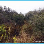
Zuma Canyon Is One Of The Few Canyons In The Santa Monica Mountains That Is Accessible Only To Foot And Horse Traffic. There Are No Paved Roads. This Easy Loop Hike Begins On The Zuma Canyon Trail In Lower Zuma Canyon. The Trail Heads Up The Drainage Parallel To Perennial Zuma Creek. The Path Meanders Through Lush Riparian Vegetation That Includes Oak, Willow, Black Walnut, And Sycamore Trees. The Hike Returns On The Zuma Loop Trail Above The Canyon Floor, Traversing The East-Facing Hillside Overlooking The Canyon And The Ocean.
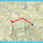
Lower Zuma Canyon Map Photo Gallery
To The Trailhead
From Santa Monica, Drive 21 Miles Northbound On The Pacific Coast Highway/Highway 1 To Bonsall Drive And Turn Right/North. (The Turnoff Is One Mile West Of Kanan Dume Road.) Continue One Mile North To The Trailhead Parking Area At Road’S End. The Last 200 Yards Are On An Unpaved Lane.
The Hike
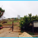
From The End Of The Road, Hike North Past The Trailhead Sign On The Zuma Canyon Trail. Follow The West Slope Of The Wide Canyon Wash 0.2 Miles To A Junction With The Zuma Loop Trail On The Left, Our Return Route. Begin The Loop Straight Ahead, Passing Oak And Sycamore Trees. Continue Past A Junction With The Ocean View Trail On The Right (Hike 115). Rock-Hop Over Zuma Creek To A Junction With The Canyon View Trail At A Half Mile, Also On The Right. Stay To The Left, Remaining Close To Zuma Creek. Pass The Scenic Trail On The Right, A Short Loop That Skirts The East Canyon Wall. Both Paths Merge 20 Yards Before The Second Creek Crossing. Cross The Creek And Walk Another 20 Yards To A Junction With The Zuma Loop Trail At 0.7 Miles. The Return Route Veers Left On The Zuma Loop Trail.
114. Zuma Loop Trail
Zuma/Trancas Canyons: Lower Zuma Canyon
To Add 1.4 Miles To The Hike, Detour To The Right, Staying On The Zuma Canyon Trail. Follow The West Side Of The Drainage. The Zuma Ridge Trail Can Be Seen To The West Near The Top Of The Canyon Wall. (The Zuma Ridge Trail Travels From The Coast And Up Zuma Ridge To Encinal Canyon Road.) Meander Up Zuma Canyon, Crossing The Creek Four More Times. At The Fourth Crossing, The Path Fades. Beyond This Point, The Trail Scrambles Up The Drainage Among The Sandstone Boulders.
Back At The Junction, Take The Zuma Loop Trail To The West And Traverse The Hillside, Continuing The Loop. Follow The Ridge South, Staying To The Left At Three Separate Trail Splits. Descend To The Canyon Floor, Completing The Loop.
Océan View-Canyon View Loop
Zuma/Trancas Canyons: Lower Zuma Canyon
Hiking Distance: 3.1-Mile Loop
Hiking Time: 1.5 Hours Configuration: Loop Elevation Gain: 600 Feet Difficulty: Easy To Moderate
Exposure: Partially Shaded Canyon Bottom And Exposed Hillside Dogs: Allowed
Maps: U.S.G.S. Point Dume N.P.S. Zuma-Trancas Canyons Map Tom Harrison Maps: Zuma-Trancas Canyons Trail Map
Lower Zuma Canyon Remains A Beautiful, Natural Stream-Fed Gorge With Minimal Development. The Perennial Stream Makes Its Way Down The Canyon Floor, Reaching The Ocean At The West End Of Point Dume. The Ocean View Trail And Canyon View Trail Form A Loop Through The Chaparral-Clad Hillside Along Zuma Canyon. The Trail Offers Great Vistas Of Zuma Canyon And The Ocean From The West-Facing Slope. This Hike Begins At The Mouth Of Zuma Canyon In A Riparian Wash Dotted With Sycamores, Oaks, Black Walnut, Willows, And Laurel Sumac Bushes.
To The Trailhead
From Santa Monica, Drive 21 Miles Northbound On The Pacific Coast Highway/Highway 1 To Bonsall Drive And Turn Right/North. (The Turnoff Is One Mile West Of Kanan Dume Road.) Continue One Mile North To The Trailhead Parking Area At Road’S End. The Last 200 Yards Are On An Unpaved Lane.
The Hike
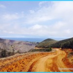
From The Mouth Of The Canyon, Head North Up The Canyon Floor For 0.2 Miles To A Signed Junction. The Zuma Loop Trail (Hike 114) Curves Left. Stay On The Canyon Bottom 30 Yards To The Posted Ocean View Trail. Bear Right To Begin The Loop. Cross A Rocky Streambed And Ascend The East Canyon Wall. Wind Up The Hillside To Views Of Point Dume And The Ocean, Reaching The Ridge At 1.3 Miles. At The Summit Are Sweeping Coastal Views That Extend (On Clear Days) To Palos Verdes, Point Mugu, And Catalina. The Ocean View Trail Ends At A T-Junction, But The Ocean Views Continue Throughout The Hike. Bear Left 0.1 Mile On The Unpaved Kanan Edison Road To A Junction With The Canyon View Trail. Curve Left And Follow The Ridge Across The Head Of The Small Side Canyon. Weave Down The Hillside To The Canyon Floor And A Junction At 2.6 Miles. Bear Left On The Zuma Canyon Trail And Walk Down Canyon. Parallel The Small Stream Past Laurel Sumac Bushes And Sycamore Trees. Complete The Loop And Return To The Trailhead.
Maybe You Like Them Too
- The Best Places To Visit In North America For Christmas
- Faro Travel Guide: Map of Faro
- Mumbai Travel Guide For Tourists: Map Of Mumbai
- Travel to Budapest
- Thailand Travel Guide for Tourists: The Ultimate Thailand Map

