Hiking Distance: 1.5 Miles Round Trip
Hiking Time: 45 Minutes
Configuration: Several Short Out-And-Back Trails
Elevation Gain: 200 Feet
Difficulty: Easy
Exposure: Exposed
Dogs: Not Allowed
Maps: U.S.G.S. Point Dume Tom Harrison Maps: Zuma-Trancas Canyons Trail Map
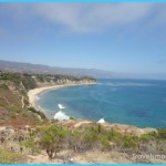
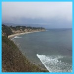
Point Dume Natural Preserve Is A 35-Acre Blufftop Preserve On The Northwest End Of Santa Monica Bay (Front Cover Photo). Volcanic Rock Cliffs Jut Out To Sea Along A Triangular-Shaped Headland That Is Surrounded By Water On Three Sides. From The 203-Foot Perch At The Tip Of The Promontory, Views Extend Across Santa Monica Bay, From Point Mugu To Palos Verdes.
Point Dume Natural Preserve Map Photo Gallery
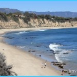
From Mid- December Through March, The Summit Is Among The Finest Sites To Observe The Migrating Gray Whales En Route From The Bering Sea To Baja California. On The West Side Of The Point Is Point Dume State Beach, A Popular Swimming And Sunbathing Beach With A Rocky Shoreline And Many Tidepools To Explore. To The East, Tucked Beneath The 200-Foot Sandstone Cliffs, Is Dume Cove (Locally Known As Pirates Cove), A Secluded, Unofficial Clothing-Optional Beach Between Two Rocky Points. This Hike Climbs The Ancient Coastal Bluffs Through Coastal Scrub, Grassland, And Dunes To Coastal Overlooks And An Oceanfront Viewing Platform.
Point Dume
Natural Preserve
From Santa Monica, Drive 20 Miles Northbound On The Pacific Coast Highway/Highway 1 To Westward Beach Road By Point Dume And Turn Left/Oceanside. (Westward Beach Road Is 0.9 Miles West Of Kanan Dume Road.) Turn Left And Drive 0.6 Miles To The Point Dume State Beach Entrance Station. Continue 0.7 Miles To The Far South End Of The Parking Lot. A Parking Fee Is Required.
For A Second Access Point, Just Before Reaching The Beach Entrance Station, Turn Left On Birdview Avenue, And Drive 1 Mile To Limited Curbside Parking Spaces On The Right. (Birdview Avenue Becomes Cliffside Drive En Route.)
The Hike
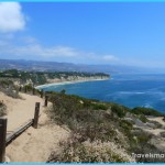
Walk Towards The Cliffs, Past The Trailhead Gate, At The Point Dume Natural Preserve Boundary. Wind Up The Hill On The Footpath To A Junction. The Left Fork Leads To Birdview Avenue In A Residential Neighborhood. Stay To The Right To A Second Junction. The Right Fork Follows The Ridge To A Rocky Point And Ends At A Fenced Overlook. Return To The Junction And Take The Other Fork. A Short Distance Ahead Is A 4-Way Junction. The Left Fork Loops Around The Terraced Flat With Coastal Sage Scrub To Birdview Avenue; It Also Connects With The Beach Access To Dume Cove. The Right Fork Leads Uphill To The Summit, 203 Feet Above The Ocean. The Middle Fork Follows A Boardwalk To A Platform Overlook. From The Platform, A Sandy Path Continues A Short Distance Around To The Point.
Return To The Beach Access, And Descend On The Trail And Stairs To Dume (Pirates) Cove At The Base Of The Cliffs. At Low Tide, Explore The Tidepools And Walk Along The Rocky Shoreline Northeast Into Paradise Cove, A Privately Run, Crescent-Shaped Beach With A Small Pier And Concessions.
Maybe You Like Them Too
- The Best Places To Visit In North America For Christmas
- Faro Travel Guide: Map of Faro
- Mumbai Travel Guide For Tourists: Map Of Mumbai
- Travel to Budapest
- Thailand Travel Guide for Tourists: The Ultimate Thailand Map

