Portuguese Bend Overlook
Hiking distance: 2.8 miles round trip Hiking time: 1.5 hours Configuration: out-and-back with loop Elevation gain: 500 feet Exposure: exposed with shaded pockets Difficulty: easy to moderate Dogs: allowed Maps: U.S.G.S. Torrance.
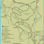
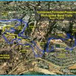
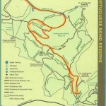
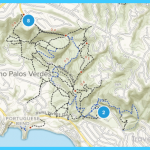
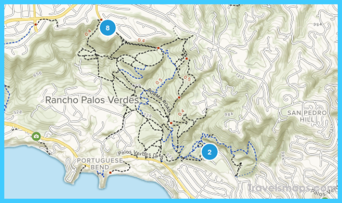
Portuguese Bend Reserve Map Photo Gallery
This hike begins in Del Cerro Park in Rancho Palos Verdes, which sits atop the Palos Verdes Peninsula at more than 1,100 feet. From the park overlook are spectacular southern views of the 13 distinct marine terraces that make up the peninsula and the massive 270-acre landslide area of Portuguese Bend. The Crenshaw Extension Trail descends from Del Cerro Park into the precarious bowl-shaped canyon, still active with faults and shifting ground. A trail system winds through the rolling green hills and ancient wave-cut terraces to the shady Portuguese Bend Overlook, perched high above Portuguese Bend, Portuguese Point, and Inspiration Point (Hike 53).
To the trailhead
From the Pacific Coast Highway/Highway 1 at the south end of Torrance, take Crenshaw Boulevard south 3.9 miles to the trail-head at the end of the road.
The hike
Before starting down the trail, walk 30 yards up the road, and bear left into Del Cerro Park for a bird’s-eye view of the surrounding hills, coastline, and the trails you are about to hike. Return to the metal trailhead gate, and take the unpaved road, passing a few hilltop homes. Descend into the unspoiled open space overlooking layers of rolling hills, the magnificent Palos Verdes coastline, and the island of Catalina. At just under a half mile is a 3-way trail split by a water tank on the left. Follow the main road, curving to the right a quarter mile to an unsigned footpath on the left. Detour left to the distinctive 950-foot knoll dotted with pine trees. From the overlook are sweeping coastal views, including Point Vicente, Portuguese Point, Inspiration Point, and
Catalina Island.
Return from the overlook to the main trail. Continue downhill, curving left on a wide horseshoe bend. Just beyond the bend, a road veers off to the right, leading to Narcissa Drive. Twelve yards past this road split is a distinct footpath on the left. Leave the road and take this path through a forest of feathery sweet fennel plants. The path curves left, overlooking Portuguese Canyon. A switchback cuts back to the west and climbs the hillside to a ridge at a T-junction. The right fork follows the ridge uphill to the summit again, completing a loop on the pine-covered knoll. Descend from the knoll to the main trail (the same route hiked earlier). Bear right, returning to the trailhead. I
Portuguese Bend Overlook
Crenshaw Extension Trail from Del Cerro Park
55. South Coast Botanic Garden
26300 Crenshaw Boulevard Palos Verdes Peninsula Open daily 9 a.m -5 p.m.
Hiking distance: 1-2 miles round trip
Hiking time: 1-2 hours
Configuration: many inter-connecting paths
Elevation gain: 100 feet
Exposure: mixed sun and shade
Difficulty: very easy
Dogs: not allowed
Maps: U.S.G.S. Torrance South Coast Botanic Garden map
The South Coast Botanic Garden, owned by Los Angeles County, was developed on a sanitary landfill site in 1959. The 87-acre garden includes plant collections that represent southern Africa, Australia, and the Mediterranean. Within this impressive garden is a rose garden with more than 1,600 hybrids that circles a large fountain, a children’s garden with a miniature enchanted house, a gazebo, an arched bridge over a fish pond, a succulent and cactus garden, herb and vegetable gardens, a fuchsia garden, and a water-wise garden. A large man-made lake with an island supports an abundant bird population. A canyon with a channel of water winds through ripari an and marshland habitats, a woodland of pines and junipers, coastal redwoods, flowering fruit trees, palm trees, and over 50 species of eucalyptus trees.
To the trailhead
From the Pacific Coast Highway/Highway 1 at the south end of Torrance, take Crenshaw Boulevard south 1 mile to the posted turnoff on the left. Turn left and drive 0.2 miles to the parking lot. An entrance fee is required.
The hike
Walk past the gift shop to a hub of trails at the top of the garden. A paved road/trail circles the perimeter of the botanic garden. Numerous unpaved roads and trails weave through the tiered landscape leading to the lake. Let your interests lead you through the gardens along your own route.
Maybe You Like Them Too
- The Best Places To Visit In North America For Christmas
- Faro Travel Guide: Map of Faro
- Mumbai Travel Guide For Tourists: Map Of Mumbai
- Travel to Budapest
- Thailand Travel Guide for Tourists: The Ultimate Thailand Map

